Winning Team: ReNew Orleans
Team members: Patrick McAdam, Ching Wei Leung, Monika Koppuravuri, Yu Qing Ingrid Fung, Bhavya Sharma, Matthew James Liam Cawley, Zanna Louise Buckland, Zile Feng, Denny Semanaj, Erica Gong & Ling Liu | Imperial College London
Faculty advisors: Professor Mike Cook & Dr Sunday Popo-Ola | Imperial College London
The winning proposal reinvents Read and Lake Forest Corridors site into a green & thriving neighbourhood by focusing on the following key areas:
Developing a pedestrianised Lake Forest Green Corridor
Advancing high-tech transportation via a BRT with a flat $1 fare pricing structure
Expanding community space with an amphitheatre sheltered by a green canopy
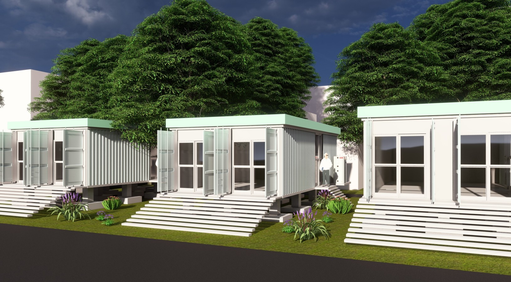
Building climate-resilient, affordable housing with green roofs using freight containers
Generating green energy through a solar microgrid, including 16 resilience hubs with solar panels and batteries across the city.
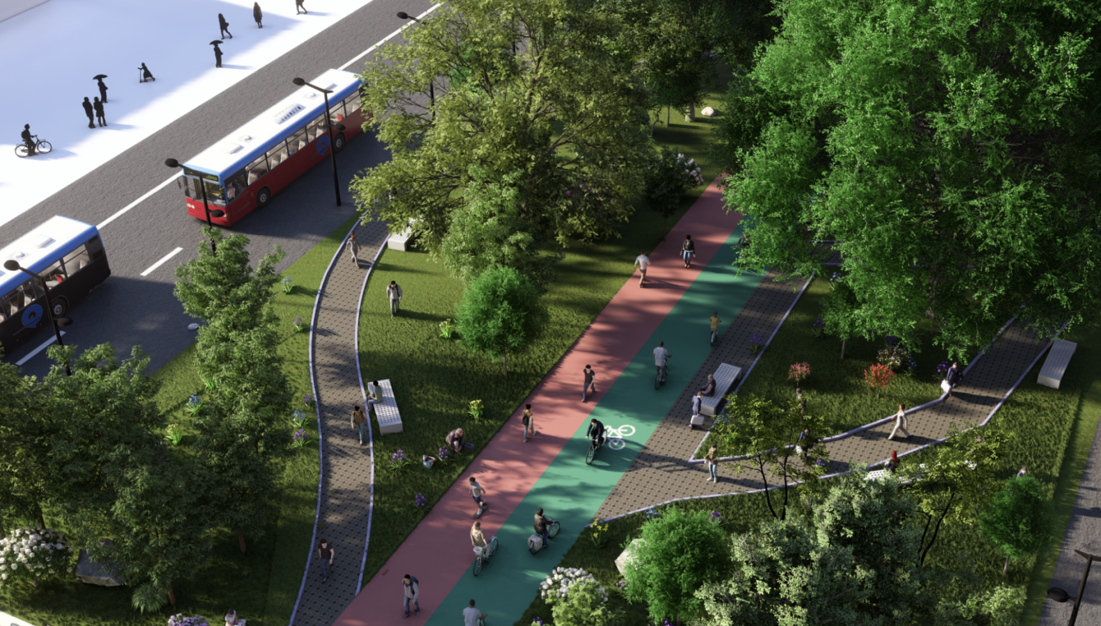
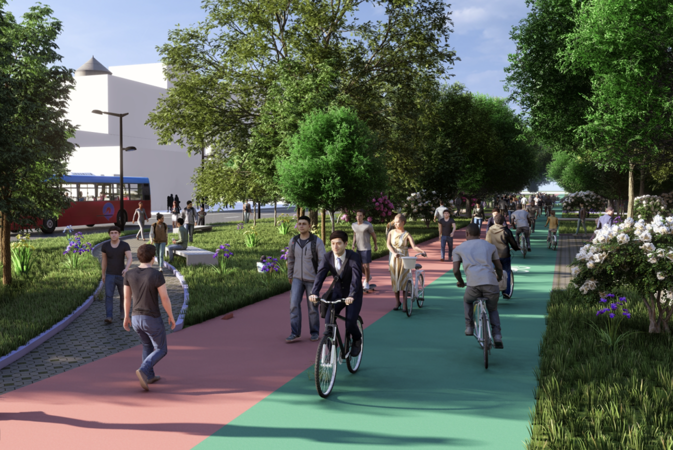
The team’s boulevard design features a footpath and bicycle track in the centre, bordered with native greenery, such as the Louisiana Iris, to shelter pedestrians. On the outer sides, two road lanes would allow buses and emergency vehicles to pass through in either direction to dramatically limit road traffic passing, whilst reducing air and noise pollution. The proposal uses Kiacrete as the paving surface, a novel anti-clogging concrete technology to boost stormwater resilience.
Find the team's winning proposal, as well as a recognition of all teams that participated, in the documentation tab!
Honourable mention | Team People First
Team members: Mya Butler, Ileanna Calcano, Natalia Arredondo, Leila Avery, Sydney Lowman & Evan Roden | Loyola University New Orleans
External advisors: Bara Watts & Dr Craig S. Hood | Loyola University New Orleans
Jury members that assessed all submitted proposals included:
- Neuni Farhad, Urban Resilience Mainstreaming Senior Manager | C40 Cities
- Siobhan Foley, Head of Sustainable Consumption | C40 Cities
- Greg Nichols, Deputy Chief Resilience Officer, Office of Resilience & Sustainability |City of New Orleans
- Sydney Shivers, Interim Director, Office of Community Assets and Investment | City of New Orleans
- Ellen Soll, Senior Project Manager | Alliance Transportation Group
- Dawn Hebert, President | East New Orleans Neighborhood Advisory Commission
- Brenda Jackson, Vice Chancellor for Research/Strategic Initiatives | Southern University New Orleans (SUNO)
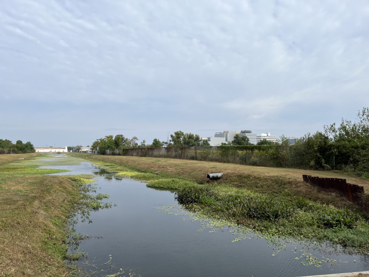
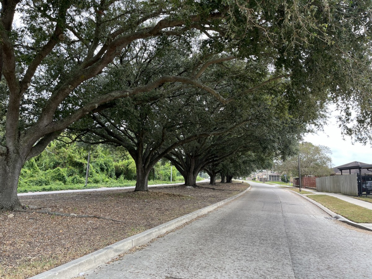
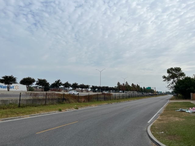
The study area comprises two
major corridors, Read Boulevard and Lake
Forest Boulevard and is approximately 339
hectares. It includes both major commercial
thoroughfares as well as residential
neighbourhoods with both single-family and
multi-family homes. The City’s Master Plan
identifies this area as an “opportunity site” given
its potential for community-based
redevelopment. The City’s Regional Transit
Authority (RTA) has established a transit hub at
the intersection of these two streets and is
studying the area as a main route for the
establishment of a bus rapid transit system
(BRT) in the near future.
The neighbourhood, like much of New Orleans East, has experienced rapid change in the last four decades. The site has historically included the middle-class African American base of the City, however, has struggled with increased poverty, particularly since Hurricane Katrina devastated the neighbourhood. The area has also struggled with commercial disinvestment since then, although new opportunities may soon come to fruition. In addition, there are several city-owned properties in this area, such as Joe Brown Park and several undeveloped city properties, which the City could use as cornerstones of a redevelopment strategy. The area has a disconnected network of bicycling and pedestrian paths in the area and the City hopes that new developments, such as the recently completed Lake Forest Manor, a 200-unit complex for seniors adjacent to this area, can be used to comprehensively plan a network of transportation options for residents in the area.
The City’s primary goal is a community-based redevelopment strategy that improves the quality of life for residents through clean energy solutions and makes walking, biking, and transit options safe, connected and the preferred modes of transportation for residents. In the City’s 2017 and updated 2022 Climate Action Plans the City has set a goal of 50% non-automobile trips by 2030 to reduce emissions from transportation. The City hopes this challenge will provide inspiration for redeveloping a key portion of the City that is geographically separated by the Industrial Canal.
Approx. site area
339 hectares (1.31 square miles)
Key Information
This area of the City is approximately 88% African-American and the average household income is $43,169, compared to $73,963 citywide.
Priority areas & main expectations
The
main priority for the city is to envision the
redevelopment of key portions of this
neighbourhood in a way that increases local
access to key amenities and thus decreases
vehicle emissions. Furthermore, it is critical
that community needs are reflected within
the design with a focus on affordable
housing, safety, reduced energy burden and
reliable, connected, and safe transportation.
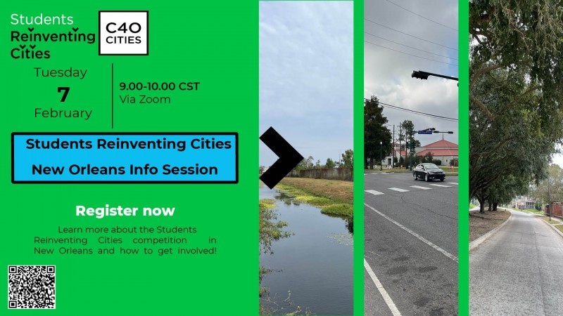
Watch the recording of the New Orleans Infomration Session here!
The Team-up contact form is now available. Click here to connect and team-up with other participants who are interested in the same site/city. The contacts provided can be found here.
Download specific documents for this site
Keep me posted!
Questions?
If you have a question or would like more details on the site and the Students Reinventing Cities competition, please use the form below. You will receive a response via email.
