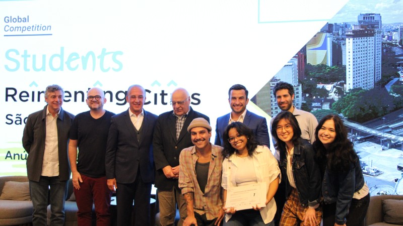
Winning Team: Anhangá-ba-y
Team members: Anabella Akiko Tsai Miyanishi, Letícia Siqueira Campos Rebecca, Luiz Felipe de Lourenço Silveira & Melissa Grazielle de Araújo | Instituto Federal de São Paulo (IFSP)
External Advisors: Profa. Dra. Ana Carolina Carmona Ribeiro & Prof. Dr. Douglas Luciano Lopes Gallo
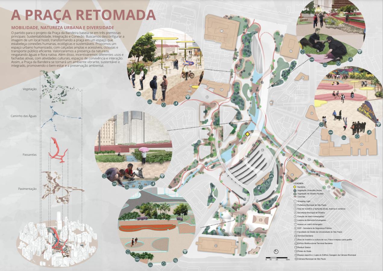
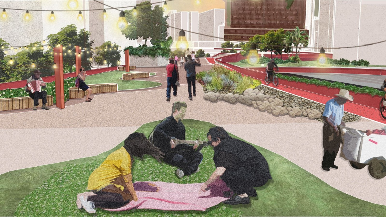
Team Anhangá-ba-y 's winning proposal reimagines Praça da Bandeira into a safe, accessible hub powered by sustainable energy sources. The proposal reimagines a viaduct previously intended for vehicular traffic converted into a "walkway-park" with flowerbeds and vegetation. This "walkway-park” will also connect to other walkways underground, thus connecting City Hall, subway stops, and transport terminals, creating a safe and affordable environment.
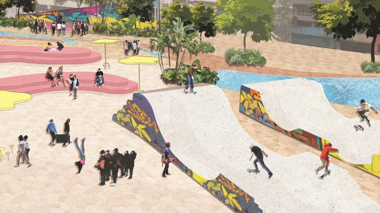
The project also aims to create a Sports and Leisure Plaza in a car park building attached to the Town Hall, utilizing large, under-utilized slabs to establish connections between the bus station, Town Hall, Paulo Kobayashi Square, and the Bela Vista neighbourhood.
The project will also include renewable energy sources such as solar panels on building roofs, energy-saving LED bulbs in public lighting systems, increasing tree cover to provide shade, and reintroducing native fauna and flora species.
Learn more about their project by taking a look at the full proposal in the documentation tab!
Special Mention | Team Estúdio ArqBio
Team members: Ellen Caroline Cosendey Leal, Gabriel Meirelles, Giulia Scavassini Benatti, Julia Martins Dias, Thayná Dias do Nascimento Costa & Renan Gregorio Dias Severgnini | Universidade Paulista (UNIP)
External Advisors: Profa. Dra. Bianca Jo Silva & Pamela Alves Bandeira da Silva (Arquiteta e Urbanista)
Jury members assessed all submitted proposals included:
- Beatriz Messeder Sanches Jalbut | Architect and Urban Planner. Beatriz works in urban legislation, urban planning and urbanism ahead of the technical coordination of the Urban Policy Council (CPU) of the Commercial Association of São Paulo – ACSP. Beatriz was a member of the Judging Committee of the competition “Reinventing Cities São Paulo” in the year 2022.
- Gustavo Garrido Architect, Urban Planner and founding partner of the ARCHSCAPE office. Gustavo was on the board of the Brazilian Association of Landscape Architects – ABAP from 2018 to 2020 and is currently on the board of the Brazilian Association of Architectural Offices of the São Paulo Region – AsBEA-SP.
- Ilan Cuperstein serves as Regional Director for Latin America at C40 cities. Ilan helps Latin American cities implement their climate action plans in a variety of areas and is responsible for launching the C40 Clean Energy Network, with over 30 participating cities from various C40 regions.
- Marcela Evans Soares, architect, urban planner and Manager of Urban Planning and Projects at São Paulo Urbanismo. Marcela was the president of the Special Bidding Commission for the “Reinventing Cities São Paulo” competition, in 2022, and is the president of the Special Monitoring Commission of SPUrbanismo in the “Students Reinventing Cities São Paulo - 2023” Contest.
- Andre Ramos is an architect and urbanist. Andre has worked in public power with the Municipal Housing Secretariat, in the slum upgrading program, in the City Council with the office of the rapporteur of the 2014 Master Plan and, since 2015, works as a development analyst for São Paulo Urbanismo. André was a member of the Judging Committee of the competition “Reinventing Cities São Paulo”, in the year 2022.
- Daniel Souza Lima is an architect, urban planner and specialist in Environmental Management from Centro Universitário Claretiano – CEUCLAR (2016) and acts as Full Advisor to the Management of Urban Plans and Projects at São Paulo Urbanismo. Daniel supervised, coordinated and guided the team that developed the revision of several Master Plans in the interior of Brazil, in addition to having worked on mobility projects involving Metro and CPTM lines and stations, in São Paulo.
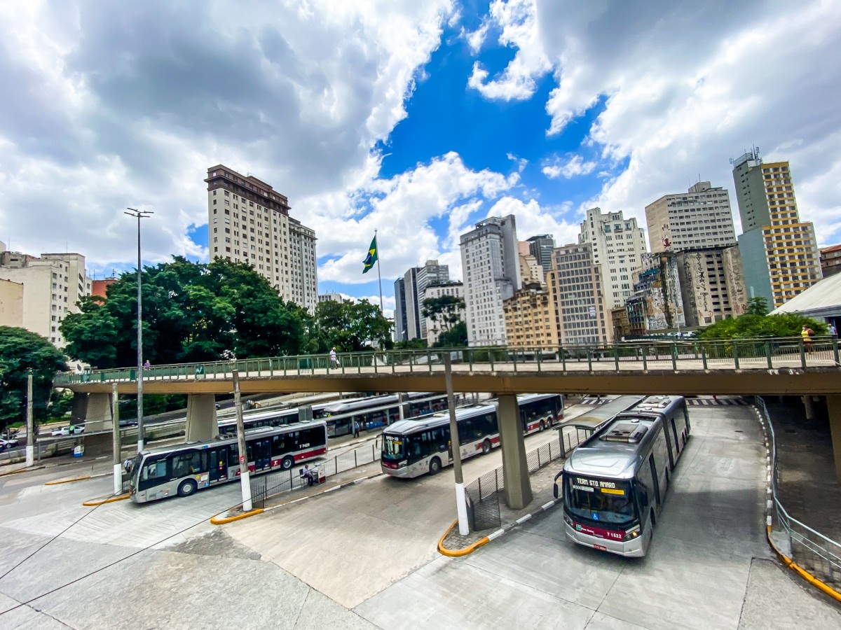
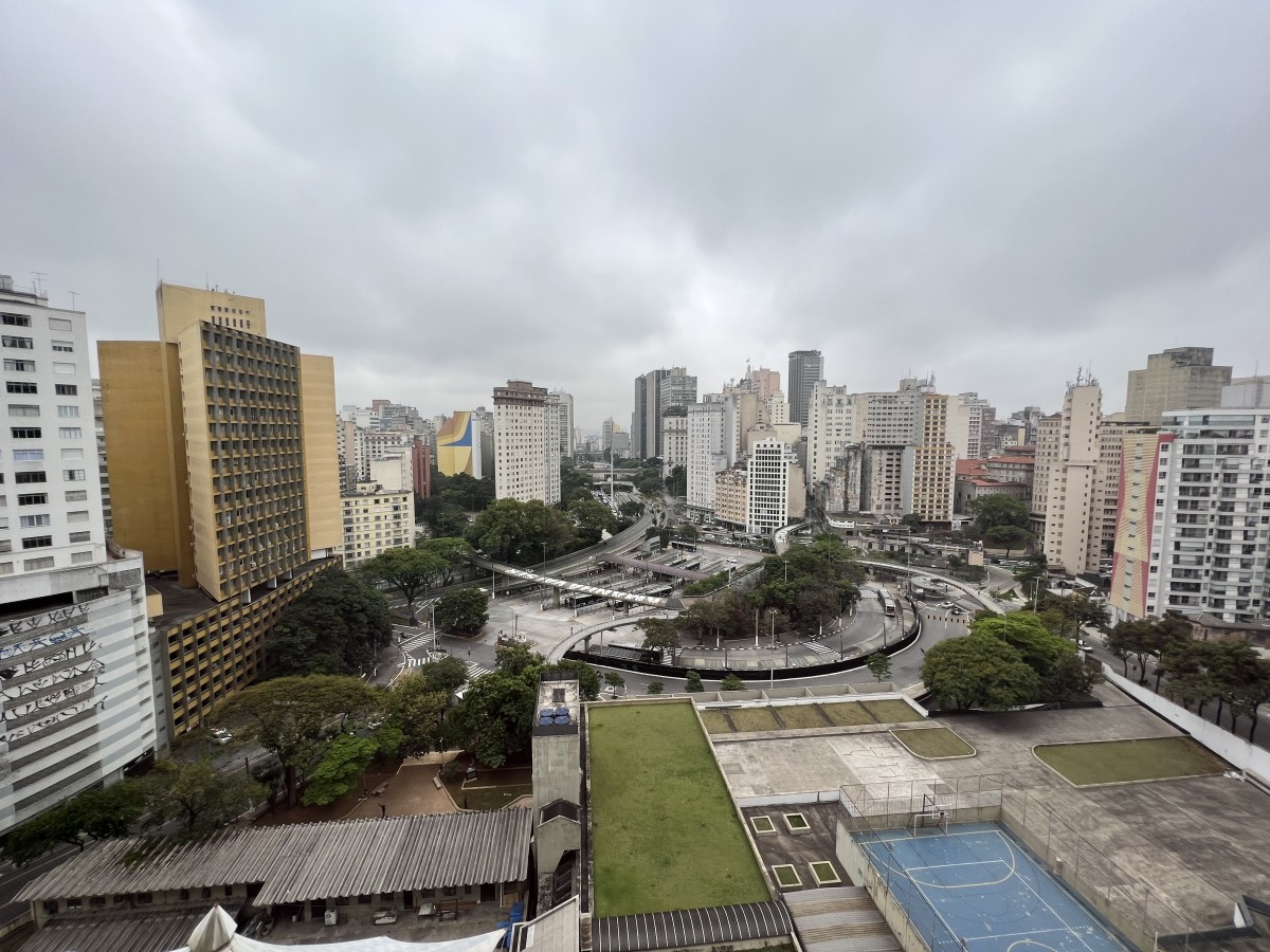
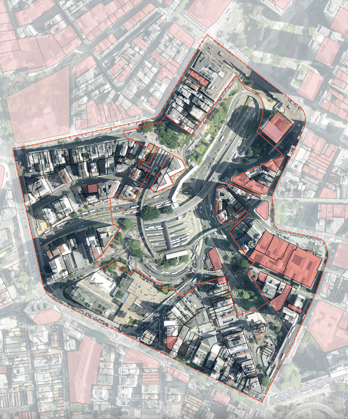
The area is characterised as one of the main routes of travel between the south and north zones of the capital of São Paulo. As a result, the area has a large circulation of vehicles, mainly because most of the space is dedicated to the municipal bus terminal, after which the square is named.
The entire area can be crossed by viaducts and by pedestrian walkways that mainly connect the terminal to the entrances to the Anhangabaú subway station. There is a walkway connecting the terminal to Largo da Memória, a historic site in the city centre and home to the first monument in São Paulo, the Obelisco dos Piques.
This portion of the city is well served by public transportation with bus and metro lines, including the Princesa Isabel, Praça do Correio and Parque Dom Pedro bus terminals and the Sé, São Bento, República, Anhangabaú and Luz metro stations. However, communal living spaces are scarce, and it is worth noting that vehicle traffic still takes priority in urban design
The square is surrounded by important buildings such as the São Paulo City Council building, the Red Bull Station Cultural Center, Shopping Light, Vale do Anhangabaú and the Matarazzo Building, (the current headquarters of the City Hall of São Paulo).
The Bandeira Square is in the inner portion of the area formed by a ring road, better known as Rótula Central. This ring road symbolically surrounds and reduced access to the Historic Centre, a design implemented at a time when city urban interventions prioritised car traffic.
Approx. site area
76.771 m²
Key Information
The Bandeira Terminal has a total area of 19,900 square meters, serves 19 bus lines and receives approximately 40,000 passengers per day. It has paid integration with Metro Line 3, through Anhangabaú Station.
Priority areas & main expectations
- The main objective is to make Bandeira Square a pleasant place for pedestrians to circulate, with a focus on walkability, active mobility, and the creation of green areas.
- Secondly, proposals should redesign the space by restructuring the road junctions and connections between the two margins of the Vale do Anhangabaú, as well as between the buildings of the City Council and City Hall of São Paulo. Proposals should also rethink the functioning of the Urban Terminal and the three channelled streams that pass through the site (Saracura, Itororó and Bixiga) and the Anhangabaú stream.
- Finally, it is essential that proposals consider best practices for low-carbon urban development, in order to promote more resilient and sustainable spaces.
The Team-up contact form is now available. Click here to connect and team-up with other participants who are interested in the same site/city. The contacts provided can be found here.
Download specific documents for this site
Keep me posted!
Questions?
If you have a question or would like more details on the site and the Students Reinventing Cities competition, please use the form below. You will receive a response via email.
