
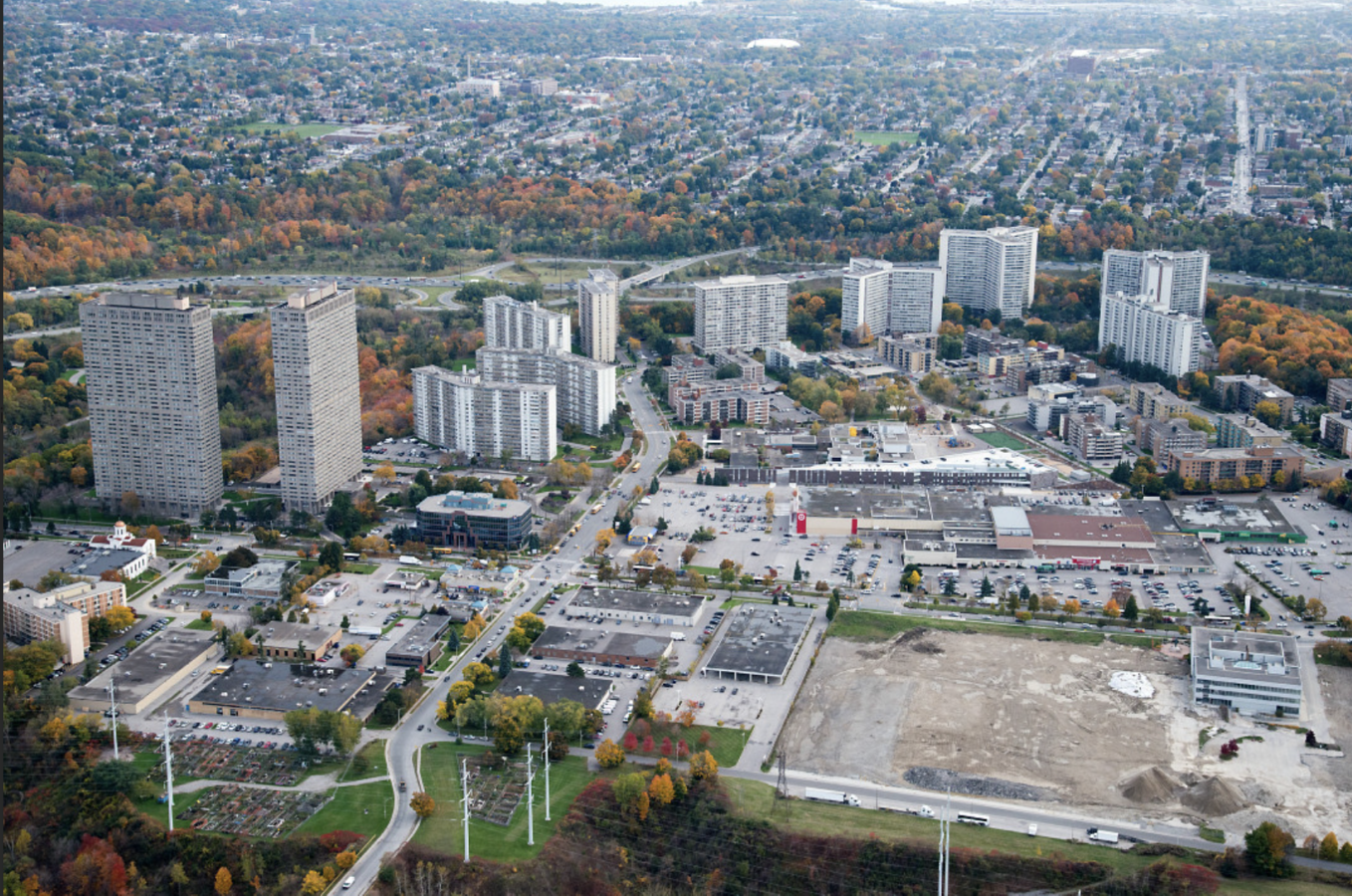
Thorncliffe Park, connected to Thorncliffe Park Major Transit Station Area, is a fast-growing neighbourhood in northeast Toronto.
The area is undergoing major changes, largely due to the construction of the Ontario Line (OL). This new 15.6km rapid transit line, with interchanges to Lines 1, 2, and 5 of the Toronto Transit Commission (TTC), will connect downtown Toronto to Eglinton Avenue, going through Thorncliffe Park.
As a result, the Thorncliffe Park study site will be significantly transformed from its current employment use and low-density built form to a higher-density transit-oriented form of development, with a future elevated guideway and transit station proposed within the site boundaries. A holistic planning approach is necessary to address land use, built form, servicing capacity, streets and blocks, parks and open spaces, heritage, and environmental considerations.
Thorncliffe Park is identified as one of 31 Neighbourhood Improvement Areas (NIA) in the city. The Toronto Strong Neighbourhoods Strategy (TSNS) is Toronto’s action plan for increasing equitable opportunities for designated neighbourhoods by building partnerships so they can succeed and thrive. Action items in this report will ensure that equity, adequate affordable housing options, displacement and gentrification are addressed in redevelopment proposals for the area.
This report, along with the Official Plan, relevant Secondary Plans (Don Mills Crossing) and the City of Toronto's Housing Action Plan, are provided in the Dataroom, and teams should refer to these documents when developing their designs.
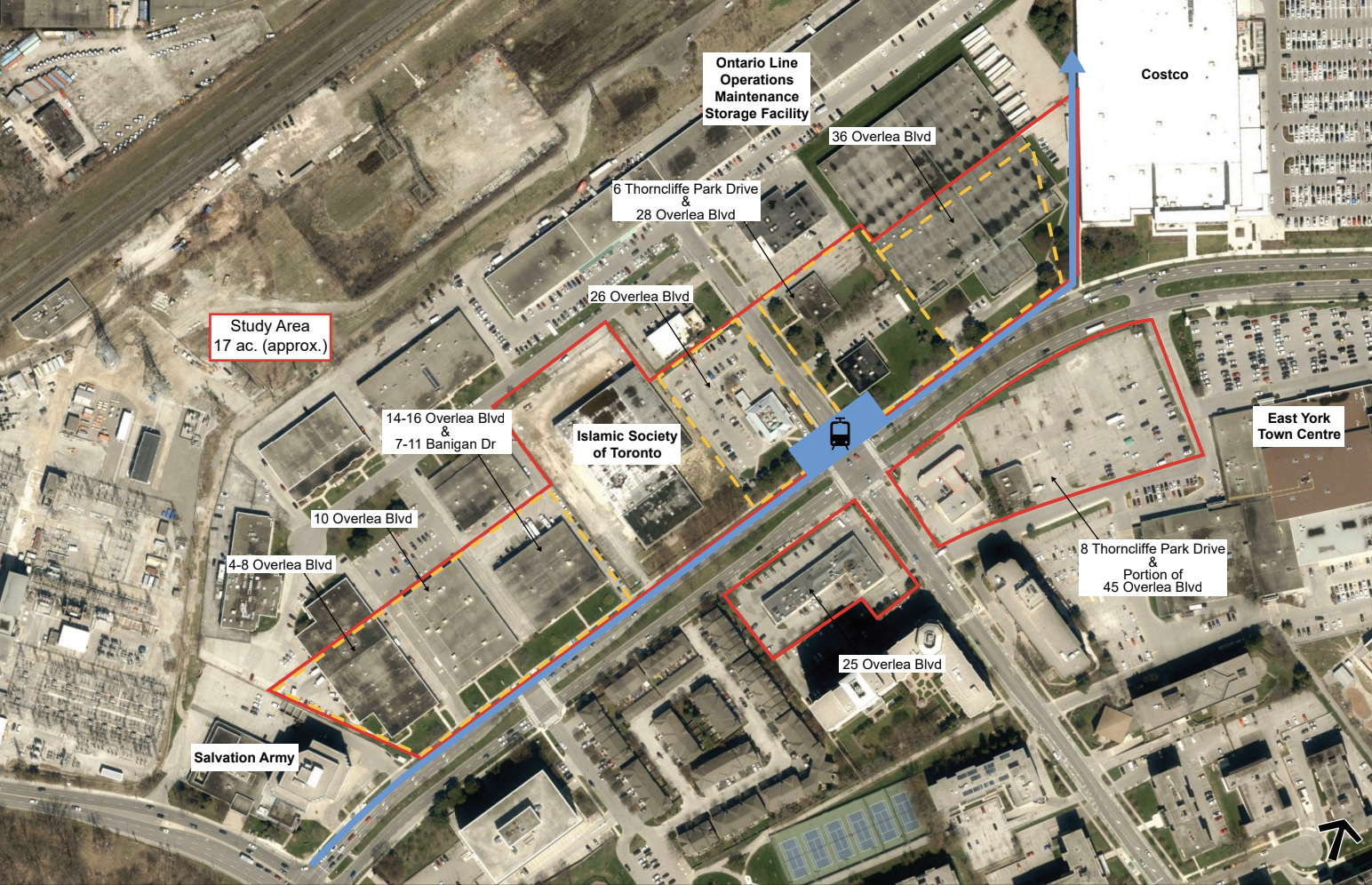
Approx. site area:
- 17 acres in size.
- The site is generally flat and of sufficient size to consider as a precinct.
Key Information
- The wider neighbourhood is home to a large and diverse immigrant community of newcomer, younger and lower-income families living in mostly high-rise and townhouse developments, with large South Asian representation.
Priority areas & main expectations:
Students should develop a holistic mini-precinct plan that promotes livability, equity and resilience, with a special focus on the following priorities:
-
Introduce public art and strategies to activate the public realm at prominent locations.
-
Develop a Transport Oriented Community, by connecting the new Thorncliffe Park transit station to the existing neighbourhood by creating a walkable public realm.
-
Integrate green infrastructure and low-impact development.
- Address land use incompatibility to create an attractive environment that supports the creation of new housing, businesses and jobs.
The evaluation of projects is currently underway, with results to be announced in September 2024. The jury panel, that will evaluate all submitted projects, consists of the following members:
- Thomas Schwerdtfeger, Program Manager Transportation Planning | City of Toronto
- Margherita Cosentino, Senior Planner | City of Toronto
- David MacMillan, Manager Public Energy Initiatives | City of Toronto
- Gladys Leung, Senior Advisor, Transit Oriented Communities | Infrastructure Ontario
- Jason Ash, Co-Founder | Friends of Thorncliffe Park
- Karma Lhamo, Manager, Community Development & Special Projects | The Neighbourhood Organization
- Michael O'Neill, Green and Thriving Neighbourhoods Project Manager | C40 Cities


Download specific documents for this site
Keep me posted!
Questions?
If you have a question or would like more details on the site and the Students Reinventing Cities competition, please use the form below. You will receive a response via email.
